Leaflet Distribution St Albans

Leaflet Network

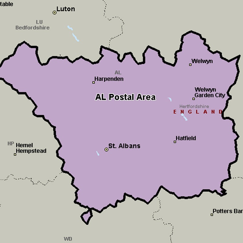
The AL postcode area, also known as the St Albans postcode area, covers central Hertfordshire, including St Albans, Harpenden, Welwyn, Welwyn Garden City and Hatfield.

Approximate total number of households in area: 98509

Get in touch with the team directly to arrange the leaflet distribution with them, or alternatively, get in touch with the leaflet network team to arrange this distribution for you. To come through the leaflet network there may be an added fee, but we will make sure to get every angle covered for you. For general enquiries please use the contact page.

alpostalarea

    Postcode SectorHouseholds
    AL1 12641
    AL1 22717
    AL1 31922
    AL1 43591
    AL1 54156
    AL10 04158
    AL10 84260
    AL10 92888
    AL2 13182
    AL2 22440
    AL2 33262
    AL3 42416
    AL3 53263
    AL3 61689
    AL3 72178
    AL3 81799
    AL4 03578
    AL4 82569
    AL4 94918
    AL5 12577
    AL5 21775
    AL5 31720
    AL5 42689
    AL5 53196
    AL6 02560
    AL6 92045
    AL7 12395
    AL7 23505
    AL7 34395
    AL7 43606
    AL8 62804
    AL8 73094
    AL9 51026
    AL9 6604
    AL9 72891

    Postal Area AL