Leaflet Distribution Bolton
Leaflet Network
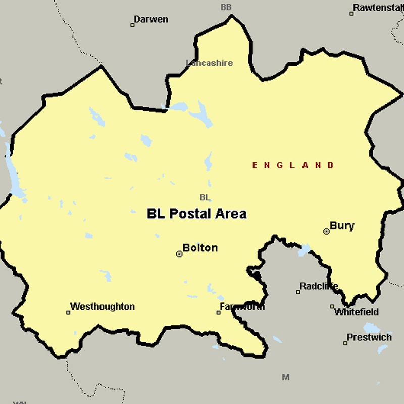
The BL postcode area, also known as the Bolton postcode area covers most of the Metropolitan Borough of Bolton and the northern and central parts of the Metropolitan Borough of Bury in Greater Manchester, plus small parts of the boroughs of Chorley, Rossendale and Blackburn with Darwen in Lancashire.
Approximate total number of households in area: 147417
Get in touch with the team directly to arrange the leaflet distribution with them, or alternatively, get in touch with the leaflet network team to arrange this distribution for you. To come through the leaflet network there may be an added fee, but we will make sure to get every angle covered for you. For general enquiries please use the contact page.
| Postcode Sector | Households |
|---|---|
| BL1 1 | 185 |
| BL1 2 | 1768 |
| BL1 3 | 4200 |
| BL1 4 | 3792 |
| BL1 5 | 4614 |
| BL1 6 | 3890 |
| BL1 7 | 3222 |
| BL1 8 | 4216 |
| BL2 1 | 1662 |
| BL2 2 | 3827 |
| BL2 3 | 3515 |
| BL2 4 | 2018 |
| BL2 5 | 4201 |
| BL2 6 | 4651 |
| BL3 1 | 4755 |
| BL3 2 | 3509 |
| BL3 3 | 5529 |
| BL3 4 | 5701 |
| BL3 5 | 2956 |
| BL3 6 | 2037 |
| BL4 0 | 3998 |
| BL4 7 | 3060 |
| BL4 8 | 3417 |
| BL4 9 | 3546 |
| BL5 1 | 1049 |
| BL5 2 | 4946 |
| BL5 3 | 4427 |
| BL6 4 | 2204 |
| BL6 5 | 4092 |
| BL6 6 | 2936 |
| BL6 7 | 3063 |
| BL7 0 | 1012 |
| BL7 8 | 246 |
| BL7 9 | 4738 |
| BL8 1 | 4787 |
| BL8 2 | 4574 |
| BL8 3 | 2994 |
| BL8 4 | 2184 |
| BL9 0 | 1078 |
| BL9 5 | 2530 |
| BL9 6 | 4197 |
| BL9 7 | 4196 |
| BL9 8 | 3675 |
| BL9 9 | 4220 |