Leaflet Distribution Dundee
Leaflet Network
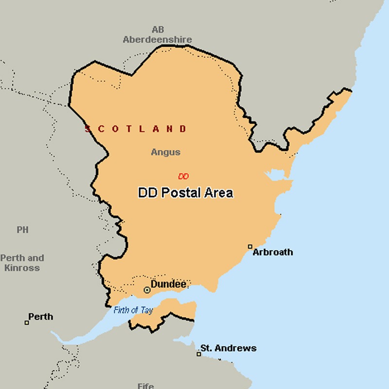
The DD postcode area, also known as the Dundee postcode area, covers Dundee and Angus (including Forfar, Arbroath, Brechin, Carnoustie, Kirriemuir and Montrose), plus part of north-east Fife (including Newport-on-Tay and Tayport) and small parts of Perth and Kinross and Aberdeenshire.
Approximate total number of households in area: 128631
Get in touch with the team directly to arrange the leaflet distribution with them, or alternatively, get in touch with the leaflet network team to arrange this distribution for you. To come through the leaflet network there may be an added fee, but we will make sure to get every angle covered for you. For general enquiries please use the contact page.
| Postcode Sector | Households |
|---|---|
| DD1 1 | 620 |
| DD1 2 | 897 |
| DD1 3 | 311 |
| DD1 4 | 988 |
| DD1 5 | 1287 |
| DD10 0 | 2184 |
| DD10 8 | 3495 |
| DD10 9 | 3350 |
| DD11 1 | 2891 |
| DD11 2 | 2185 |
| DD11 3 | 1827 |
| DD11 4 | 3054 |
| DD11 5 | 2399 |
| DD2 1 | 3939 |
| DD2 2 | 4299 |
| DD2 3 | 4655 |
| DD2 4 | 5989 |
| DD2 5 | 2980 |
| DD3 0 | 2850 |
| DD3 6 | 4288 |
| DD3 7 | 4441 |
| DD3 8 | 2919 |
| DD3 9 | 3640 |
| DD4 0 | 3469 |
| DD4 6 | 4335 |
| DD4 7 | 4237 |
| DD4 8 | 5348 |
| DD4 9 | 5521 |
| DD5 1 | 2467 |
| DD5 2 | 3700 |
| DD5 3 | 4455 |
| DD5 4 | 3883 |
| DD6 8 | 2229 |
| DD6 9 | 1648 |
| DD7 6 | 1879 |
| DD7 7 | 2810 |
| DD8 1 | 3463 |
| DD8 2 | 3025 |
| DD8 3 | 2296 |
| DD8 4 | 1867 |
| DD8 5 | 1580 |
| DD9 6 | 2436 |
| DD9 7 | 2495 |