Leaflet Distribution Durham
Leaflet Network
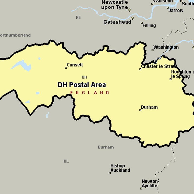
The DH postcode area, also known as the Durham postcode area, covers northern County Durham (including Durham, Chester-le-Street, Consett and Stanley) and south-west Tyne and Wear (including Houghton-le-Spring), plus a very small part of Northumberland.
Approximate total number of households in area: 125914
Get in touch with the team directly to arrange the leaflet distribution with them, or alternatively, get in touch with the leaflet network team to arrange this distribution for you. To come through the leaflet network there may be an added fee, but we will make sure to get every angle covered for you. For general enquiries please use the contact page.
| Postcode Sector | Households |
|---|---|
| DH1 1 | 3793 |
| DH1 2 | 3435 |
| DH1 3 | 1367 |
| DH1 4 | 2330 |
| DH1 5 | 5392 |
| DH2 1 | 4446 |
| DH2 2 | 4542 |
| DH2 3 | 3995 |
| DH3 1 | 3043 |
| DH3 2 | 2484 |
| DH3 3 | 2799 |
| DH3 4 | 2882 |
| DH4 4 | 3303 |
| DH4 5 | 3068 |
| DH4 6 | 3254 |
| DH4 7 | 3776 |
| DH5 0 | 3089 |
| DH5 8 | 2754 |
| DH5 9 | 3292 |
| DH6 1 | 2820 |
| DH6 2 | 3750 |
| DH6 3 | 2593 |
| DH6 4 | 2868 |
| DH6 5 | 2538 |
| DH7 0 | 2429 |
| DH7 6 | 3548 |
| DH7 7 | 3064 |
| DH7 8 | 4006 |
| DH7 9 | 4251 |
| DH8 0 | 2745 |
| DH8 5 | 2318 |
| DH8 6 | 2728 |
| DH8 7 | 3332 |
| DH8 8 | 3034 |
| DH8 9 | 1048 |
| DH9 0 | 1885 |
| DH9 6 | 4277 |
| DH9 7 | 3859 |
| DH9 8 | 2882 |
| DH9 9 | 2895 |