Leaflet Distribution Darlington
Leaflet Network
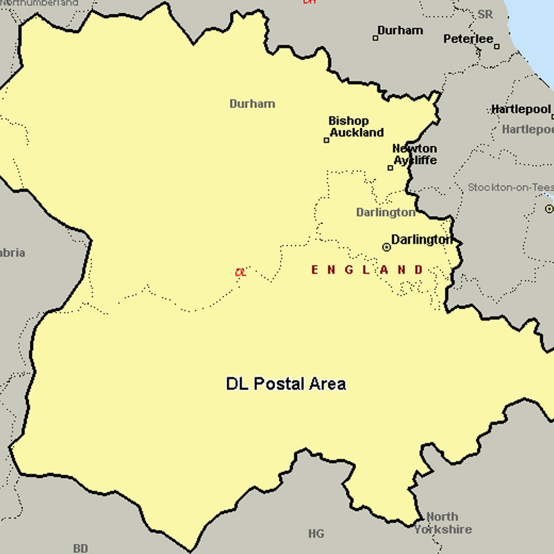
The DL postcode area, also known as the Darlington postcode area, covers central County Durham (including Darlington, Bishop Auckland, Ferryhill, Crook, Spennymoor, Shildon, Barnard Castle and Newton Aycliffe), northern North Yorkshire (including Northallerton, Bedale, Hawes, Leyburn, Richmond and Catterick Garrison) and a very small part of Cumbria.
Approximate total number of households in area: 148996
Get in touch with the team directly to arrange the leaflet distribution with them, or alternatively, get in touch with the leaflet network team to arrange this distribution for you. To come through the leaflet network there may be an added fee, but we will make sure to get every angle covered for you. For general enquiries please use the contact page.
| Postcode Sector | Households |
|---|---|
| DL1 1 | 2629 |
| DL1 2 | 5305 |
| DL1 3 | 3693 |
| DL1 4 | 5695 |
| DL1 5 | 2813 |
| DL10 4 | 2499 |
| DL10 5 | 1506 |
| DL10 6 | 1094 |
| DL10 7 | 2587 |
| DL11 6 | 1092 |
| DL11 7 | 1131 |
| DL12 0 | 1097 |
| DL12 8 | 2883 |
| DL12 9 | 1131 |
| DL13 1 | 722 |
| DL13 2 | 1454 |
| DL13 3 | 1093 |
| DL13 4 | 1251 |
| DL13 5 | 1352 |
| DL14 0 | 2876 |
| DL14 6 | 4970 |
| DL14 7 | 2107 |
| DL14 8 | 3043 |
| DL14 9 | 3196 |
| DL15 0 | 3560 |
| DL15 8 | 2238 |
| DL15 9 | 3411 |
| DL16 6 | 4739 |
| DL16 7 | 3616 |
| DL17 0 | 2431 |
| DL17 8 | 4301 |
| DL17 9 | 1660 |
| DL2 1 | 1973 |
| DL2 2 | 2159 |
| DL2 3 | 1826 |
| DL3 0 | 5971 |
| DL3 6 | 3858 |
| DL3 7 | 1427 |
| DL3 8 | 3339 |
| DL3 9 | 4437 |
| DL4 1 | 2210 |
| DL4 2 | 2442 |
| DL5 4 | 3831 |
| DL5 5 | 2867 |
| DL5 6 | 1524 |
| DL5 7 | 3924 |
| DL6 1 | 3591 |
| DL6 2 | 1696 |
| DL6 3 | 1073 |
| DL7 0 | 1131 |
| DL7 8 | 3101 |
| DL7 9 | 1711 |
| DL8 1 | 1681 |
| DL8 2 | 1741 |
| DL8 3 | 1342 |
| DL8 4 | 1450 |
| DL8 5 | 1540 |
| DL9 3 | 1598 |
| DL9 4 | 2378 |