Leaflet Distribution Dudley
Leaflet Network
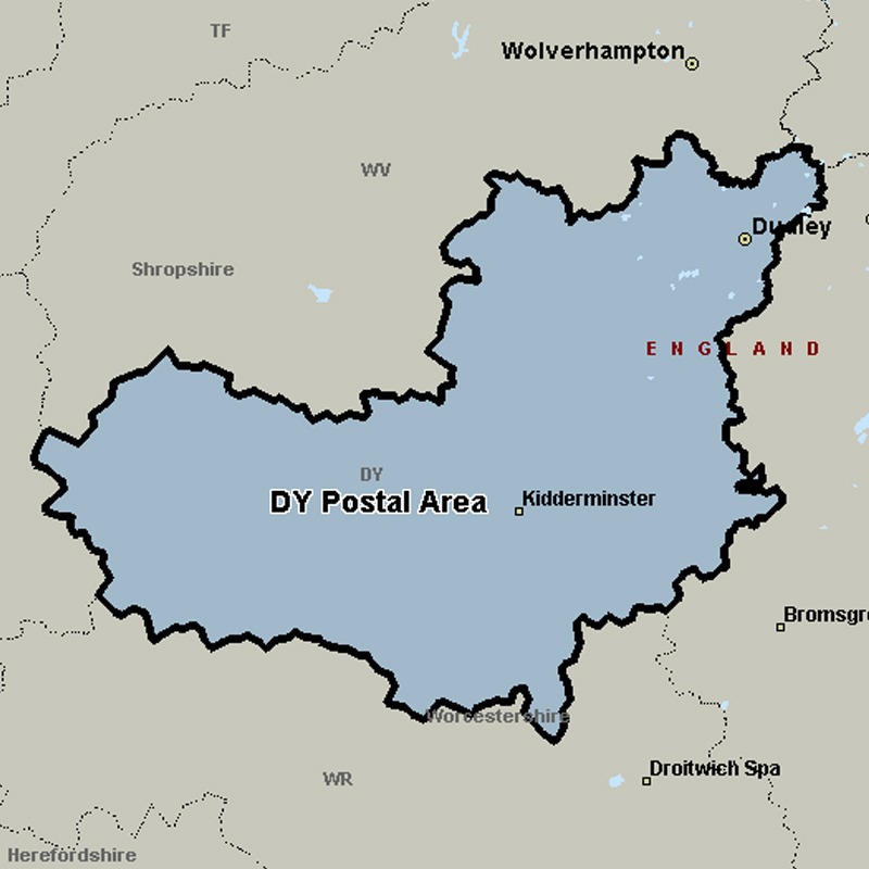
The DY postcode area, also known as the Dudley postcode area, covers the south-western part of the West Midlands (including Dudley, Tipton, Brierley Hill, Stourbridge and Kingswinford) and north Worcestershire (including Kidderminster, Bewdley and Stourport-on-Severn), plus the south-westernmost part of Staffordshire and a small part of south-east Shropshire.
Approximate total number of households in area: 167428
Get in touch with the team directly to arrange the leaflet distribution with them, or alternatively, get in touch with the leaflet network team to arrange this distribution for you. To come through the leaflet network there may be an added fee, but we will make sure to get every angle covered for you. For general enquiries please use the contact page.
| Postcode Sector | Households |
|---|---|
| DY1 1 | 473 |
| DY1 2 | 6067 |
| DY1 3 | 3722 |
| DY1 4 | 2487 |
| DY10 1 | 2852 |
| DY10 2 | 4745 |
| DY10 3 | 4525 |
| DY10 4 | 2946 |
| DY11 5 | 4281 |
| DY11 6 | 5580 |
| DY11 7 | 3047 |
| DY12 1 | 2017 |
| DY12 2 | 2433 |
| DY12 3 | 293 |
| DY13 0 | 2987 |
| DY13 8 | 3786 |
| DY13 9 | 2380 |
| DY14 0 | 539 |
| DY14 8 | 1235 |
| DY14 9 | 1056 |
| DY2 0 | 4331 |
| DY2 7 | 2850 |
| DY2 8 | 2707 |
| DY2 9 | 3394 |
| DY3 1 | 4143 |
| DY3 2 | 4971 |
| DY3 3 | 4615 |
| DY3 4 | 702 |
| DY4 0 | 6022 |
| DY4 7 | 3515 |
| DY4 8 | 4314 |
| DY4 9 | 3200 |
| DY5 1 | 2595 |
| DY5 2 | 5669 |
| DY5 3 | 5077 |
| DY5 4 | 3543 |
| DY6 0 | 1780 |
| DY6 7 | 1687 |
| DY6 8 | 4649 |
| DY6 9 | 3651 |
| DY7 5 | 606 |
| DY7 6 | 2534 |
| DY8 1 | 2719 |
| DY8 2 | 2347 |
| DY8 3 | 5388 |
| DY8 4 | 5732 |
| DY8 5 | 5057 |
| DY9 0 | 4418 |
| DY9 7 | 2342 |
| DY9 8 | 2217 |
| DY9 9 | 3202 |