Leaflet Distribution Enfield
Leaflet Network
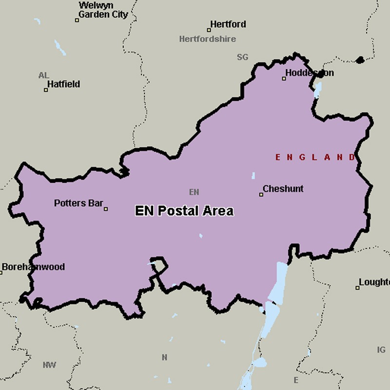
The EN postcode area, also known as the Enfield postcode area, covers parts of northern Greater London (including Enfield and Barnet), southern Hertfordshire (including Potters Bar, Waltham Cross, Broxbourne and Hoddesdon) and western Essex (including Waltham Abbey).
Approximate total number of households in area: 139619
Get in touch with the team directly to arrange the leaflet distribution with them, or alternatively, get in touch with the leaflet network team to arrange this distribution for you. To come through the leaflet network there may be an added fee, but we will make sure to get every angle covered for you. For general enquiries please use the contact page.
| Postcode Sector | Households |
|---|---|
| EN1 1 | 5065 |
| EN1 2 | 3452 |
| EN1 3 | 4681 |
| EN1 4 | 5468 |
| EN10 6 | 3723 |
| EN10 7 | 2463 |
| EN11 0 | 2397 |
| EN11 8 | 2899 |
| EN11 9 | 3010 |
| EN2 0 | 4372 |
| EN2 6 | 1470 |
| EN2 7 | 3508 |
| EN2 8 | 3343 |
| EN2 9 | 530 |
| EN3 4 | 4261 |
| EN3 5 | 6095 |
| EN3 6 | 7060 |
| EN3 7 | 3486 |
| EN4 0 | 2053 |
| EN4 8 | 4956 |
| EN4 9 | 3586 |
| EN5 1 | 3043 |
| EN5 2 | 5422 |
| EN5 3 | 1354 |
| EN5 4 | 2422 |
| EN5 5 | 3741 |
| EN6 1 | 2413 |
| EN6 2 | 3265 |
| EN6 3 | 2108 |
| EN6 4 | 2131 |
| EN6 5 | 2299 |
| EN7 5 | 2938 |
| EN7 6 | 5008 |
| EN8 0 | 4474 |
| EN8 7 | 3021 |
| EN8 8 | 4774 |
| EN8 9 | 3090 |
| EN9 1 | 3564 |
| EN9 2 | 2027 |
| EN9 3 | 4647 |