Leaflet Distribution Falkirk
Leaflet Network
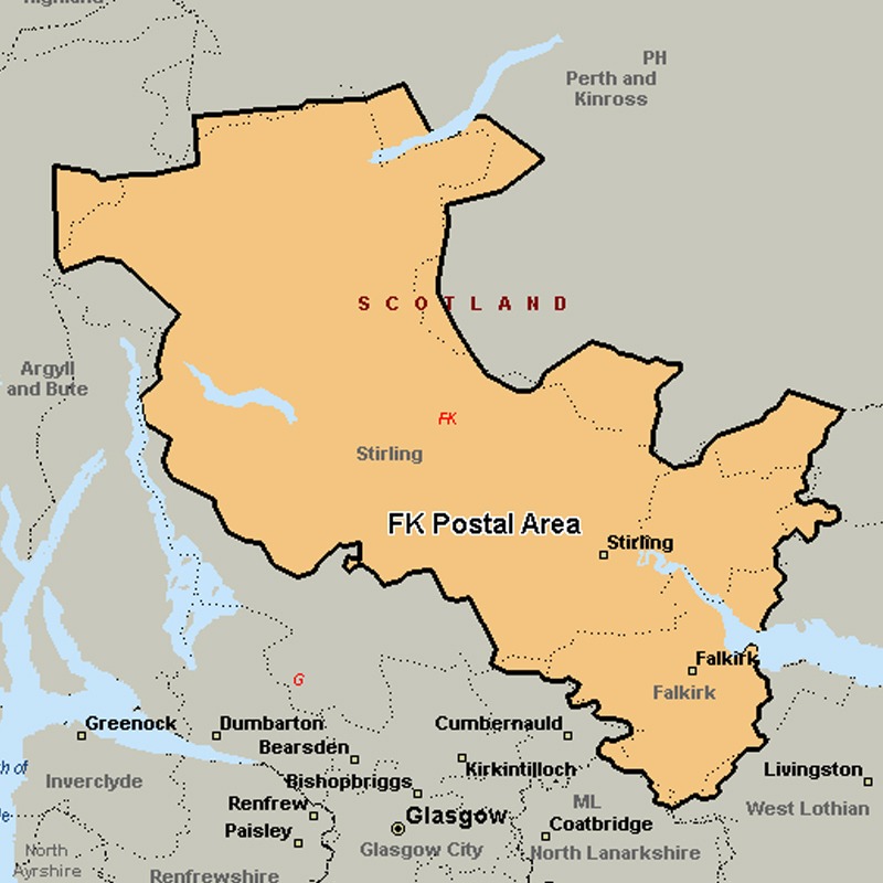
The FK postcode area, also known as the Falkirk postcode area, covers most of the Falkirk council area (including Falkirk itself, Grangemouth, Larbert, Denny and Bonnybridge), most of the Stirling council area (including Stirling itself, Dunblane, Doune, Callander, Lochearnhead, Crianlarich and Killin) and Clackmannanshire (including Alloa, Clackmannan, Menstrie, Alva, Tillicoultry and Dollar), plus small parts of Fife, Perth and Kinross, and Argyll and Bute.
Approximate total number of households in area: 109001
Get in touch with the team directly to arrange the leaflet distribution with them, or alternatively, get in touch with the leaflet network team to arrange this distribution for you. To come through the leaflet network there may be an added fee, but we will make sure to get every angle covered for you. For general enquiries please use the contact page.
| Postcode Sector | Households |
|---|---|
| FK1 1 | 2091 |
| FK1 2 | 3078 |
| FK1 3 | 736 |
| FK1 4 | 3452 |
| FK1 5 | 3327 |
| FK10 1 | 2426 |
| FK10 2 | 5758 |
| FK10 3 | 3377 |
| FK10 4 | 2907 |
| FK11 7 | 855 |
| FK12 5 | 2249 |
| FK13 6 | 2795 |
| FK14 7 | 1663 |
| FK15 0 | 1583 |
| FK15 9 | 2192 |
| FK16 6 | 753 |
| FK17 8 | 1462 |
| FK18 8 | 96 |
| FK19 8 | 239 |
| FK2 0 | 5602 |
| FK2 7 | 4827 |
| FK2 8 | 3209 |
| FK2 9 | 4382 |
| FK20 8 | 146 |
| FK21 8 | 448 |
| FK3 0 | 2456 |
| FK3 8 | 3534 |
| FK3 9 | 2535 |
| FK4 1 | 3628 |
| FK4 2 | 1001 |
| FK5 3 | 2025 |
| FK5 4 | 4807 |
| FK6 5 | 2929 |
| FK6 6 | 2401 |
| FK7 0 | 3009 |
| FK7 7 | 4410 |
| FK7 8 | 2255 |
| FK7 9 | 2952 |
| FK8 1 | 3169 |
| FK8 2 | 1498 |
| FK8 3 | 2267 |
| FK9 4 | 2238 |
| FK9 5 | 2234 |