Leaflet Distribution Hemel Hempstead
Leaflet Network
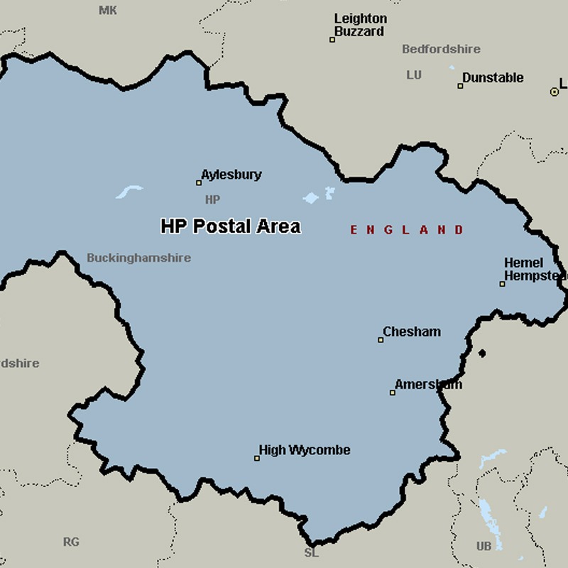
The HP postcode area, also known as the Hemel Hempstead postcode area, covers north-west Hertfordshire (including Hemel Hempstead, Berkhamsted and Tring) and central Buckinghamshire (including Aylesbury, High Wycombe, Beaconsfield, Amersham, Chalfont St Giles, Chesham, Great Missenden and Princes Risborough).
Approximate total number of households in area: 195244
Get in touch with the team directly to arrange the leaflet distribution with them, or alternatively, get in touch with the leaflet network team to arrange this distribution for you. To come through the leaflet network there may be an added fee, but we will make sure to get every angle covered for you. For general enquiries please use the contact page.
| Postcode Sector | Households |
|---|---|
| HP1 1 | 3421 |
| HP1 2 | 3631 |
| HP1 3 | 3476 |
| HP10 0 | 2451 |
| HP10 8 | 2228 |
| HP10 9 | 3539 |
| HP11 1 | 2955 |
| HP11 2 | 2016 |
| HP12 3 | 3938 |
| HP12 4 | 4001 |
| HP13 5 | 5584 |
| HP13 6 | 4331 |
| HP13 7 | 6306 |
| HP14 3 | 4077 |
| HP14 4 | 3100 |
| HP15 6 | 3516 |
| HP15 7 | 3734 |
| HP16 0 | 3018 |
| HP16 9 | 1992 |
| HP17 0 | 416 |
| HP17 8 | 3347 |
| HP17 9 | 174 |
| HP18 0 | 2199 |
| HP18 9 | 2924 |
| HP19 0 | 950 |
| HP19 7 | 1920 |
| HP19 8 | 1321 |
| HP19 9 | 3578 |
| HP2 4 | 4334 |
| HP2 5 | 5669 |
| HP2 6 | 3312 |
| HP2 7 | 3116 |
| HP20 1 | 3117 |
| HP20 2 | 2567 |
| HP21 7 | 3704 |
| HP21 8 | 4702 |
| HP21 9 | 4277 |
| HP22 4 | 2192 |
| HP22 5 | 5041 |
| HP22 6 | 2701 |
| HP23 4 | 2406 |
| HP23 5 | 3229 |
| HP23 6 | 1641 |
| HP27 0 | 2657 |
| HP27 9 | 2644 |
| HP3 0 | 2983 |
| HP3 8 | 4024 |
| HP3 9 | 5693 |
| HP4 1 | 2419 |
| HP4 2 | 3398 |
| HP4 3 | 4107 |
| HP5 1 | 2992 |
| HP5 2 | 4739 |
| HP5 3 | 3078 |
| HP6 5 | 2334 |
| HP6 6 | 3599 |
| HP7 0 | 1939 |
| HP7 9 | 2714 |
| HP8 4 | 2891 |
| HP9 1 | 3609 |
| HP9 2 | 3273 |