Leaflet Distribution Hull
Leaflet Network
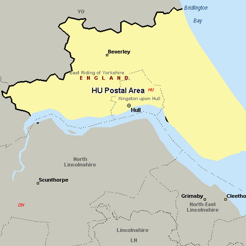
The HU postcode area, also known as the Hull postcode area, covers the south of the East Riding of Yorkshire, including Hull, Beverley, Cottingham, Hessle, Hornsea, Withernsea, Brough and North Ferriby.
Approximate total number of households in area: 188810
Get in touch with the team directly to arrange the leaflet distribution with them, or alternatively, get in touch with the leaflet network team to arrange this distribution for you. To come through the leaflet network there may be an added fee, but we will make sure to get every angle covered for you. For general enquiries please use the contact page.

| Postcode Sector | Households |
|---|---|
| HU1 1 | 371 |
| HU1 2 | 1235 |
| HU1 3 | 97 |
| HU1 4 | 4 |
| HU10 6 | 4702 |
| HU10 7 | 3345 |
| HU11 4 | 3637 |
| HU11 5 | 1467 |
| HU12 0 | 2119 |
| HU12 8 | 4507 |
| HU12 9 | 3418 |
| HU13 0 | 2919 |
| HU13 9 | 3130 |
| HU14 3 | 3316 |
| HU15 1 | 3933 |
| HU15 2 | 4301 |
| HU16 4 | 2715 |
| HU16 5 | 3960 |
| HU17 0 | 4107 |
| HU17 5 | 989 |
| HU17 7 | 3653 |
| HU17 8 | 4454 |
| HU17 9 | 4186 |
| HU18 1 | 3790 |
| HU19 2 | 3029 |
| HU2 0 | 630 |
| HU2 8 | 483 |
| HU2 9 | 659 |
| HU20 3 | 364 |
| HU3 1 | 2471 |
| HU3 2 | 2732 |
| HU3 3 | 2138 |
| HU3 4 | 107 |
| HU3 5 | 1800 |
| HU3 6 | 4214 |
| HU4 6 | 6031 |
| HU4 7 | 4641 |
| HU5 1 | 1960 |
| HU5 2 | 3556 |
| HU5 3 | 4326 |
| HU5 4 | 3876 |
| HU5 5 | 8191 |
| HU6 0 | 206 |
| HU6 7 | 4824 |
| HU6 8 | 4126 |
| HU6 9 | 5423 |
| HU7 0 | 806 |
| HU7 3 | 1491 |
| HU7 4 | 9633 |
| HU7 5 | 2464 |
| HU7 6 | 2471 |
| HU8 0 | 4442 |
| HU8 7 | 1190 |
| HU8 8 | 4136 |
| HU8 9 | 6548 |
| HU9 1 | 2055 |
| HU9 2 | 3015 |
| HU9 3 | 4438 |
| HU9 4 | 6177 |
| HU9 5 | 3802 |
