Leaflet Distribution Rochester
Leaflet Network
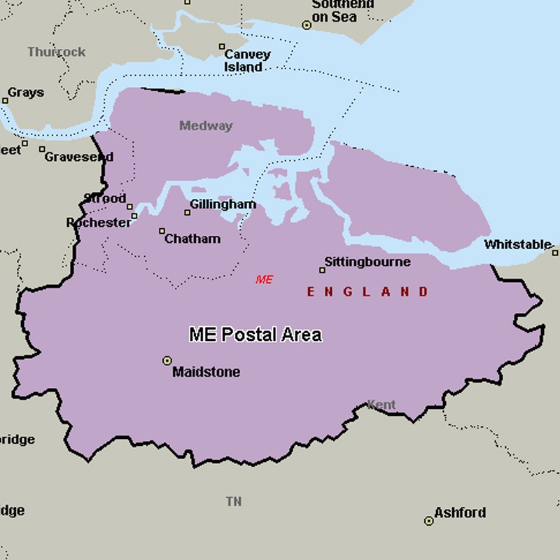
The ME postcode area, also known as the Rochester postcode area, covers north central Kent, including the Medway unitary authority and the borough of Swale, plus parts of the boroughs of Maidstone, Tonbridge and Malling, and Gravesham.
Approximate total number of households in area: 238407
Get in touch with the team directly to arrange the leaflet distribution with them, or alternatively, get in touch with the leaflet network team to arrange this distribution for you. To come through the leaflet network there may be an added fee, but we will make sure to get every angle covered for you. For general enquiries please use the contact page.
| Postcode Sector | Households |
|---|---|
| ME1 1 | 2376 |
| ME1 2 | 5949 |
| ME1 3 | 4081 |
| ME10 1 | 5862 |
| ME10 2 | 5303 |
| ME10 3 | 3040 |
| ME10 4 | 3459 |
| ME10 5 | 301 |
| ME11 5 | 1549 |
| ME12 1 | 3080 |
| ME12 2 | 4968 |
| ME12 3 | 4495 |
| ME12 4 | 2120 |
| ME13 0 | 1255 |
| ME13 7 | 3989 |
| ME13 8 | 4221 |
| ME13 9 | 2097 |
| ME14 1 | 1097 |
| ME14 2 | 4163 |
| ME14 3 | 896 |
| ME14 4 | 2340 |
| ME14 5 | 4191 |
| ME15 0 | 1674 |
| ME15 6 | 3691 |
| ME15 7 | 4573 |
| ME15 8 | 4902 |
| ME15 9 | 4249 |
| ME16 0 | 4870 |
| ME16 8 | 4323 |
| ME16 9 | 2403 |
| ME17 1 | 1959 |
| ME17 2 | 1627 |
| ME17 3 | 2015 |
| ME17 4 | 2778 |
| ME18 5 | 1969 |
| ME18 6 | 928 |
| ME19 4 | 1291 |
| ME19 5 | 2290 |
| ME19 6 | 3039 |
| ME2 1 | 2268 |
| ME2 2 | 5634 |
| ME2 3 | 4815 |
| ME2 4 | 3081 |
| ME20 6 | 5050 |
| ME20 7 | 2557 |
| ME3 0 | 645 |
| ME3 7 | 2698 |
| ME3 8 | 2836 |
| ME3 9 | 4075 |
| ME4 3 | 372 |
| ME4 4 | 1407 |
| ME4 5 | 5392 |
| ME4 6 | 3754 |
| ME5 0 | 4957 |
| ME5 7 | 5244 |
| ME5 8 | 6242 |
| ME5 9 | 5044 |
| ME6 5 | 3909 |
| ME7 1 | 4525 |
| ME7 2 | 4572 |
| ME7 3 | 3392 |
| ME7 4 | 3502 |
| ME7 5 | 3724 |
| ME8 0 | 4130 |
| ME8 6 | 4566 |
| ME8 7 | 3501 |
| ME8 8 | 4216 |
| ME8 9 | 5351 |
| ME9 0 | 1007 |
| ME9 7 | 2738 |
| ME9 8 | 1757 |
| ME9 9 | 2033 |