Leaflet Distribution Oldham
Leaflet Network
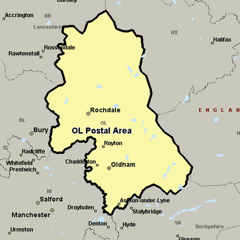
The OL postcode area, also known as the Oldham postcode area, covers eastern Greater Manchester (including Oldham, Rochdale, Ashton-under-Lyne, Heywood and Littleborough), plus small parts of east Lancashire (including Bacup) and western West Yorkshire (including Todmorden).
Approximate total number of households in area: 190317
Get in touch with the team directly to arrange the leaflet distribution with them, or alternatively, get in touch with the leaflet network team to arrange this distribution for you. To come through the leaflet network there may be an added fee, but we will make sure to get every angle covered for you. For general enquiries please use the contact page.
| Postcode Sector | Households |
|---|---|
| OL1 1 | 161 |
| OL1 2 | 2989 |
| OL1 3 | 1921 |
| OL1 4 | 4242 |
| OL10 1 | 1563 |
| OL10 2 | 2919 |
| OL10 3 | 3936 |
| OL10 4 | 4049 |
| OL11 1 | 2196 |
| OL11 2 | 4663 |
| OL11 3 | 3576 |
| OL11 4 | 2847 |
| OL11 5 | 4608 |
| OL12 0 | 2793 |
| OL12 6 | 4431 |
| OL12 7 | 4391 |
| OL12 8 | 3118 |
| OL12 9 | 4244 |
| OL13 0 | 1759 |
| OL13 8 | 1868 |
| OL13 9 | 2871 |
| OL14 5 | 2266 |
| OL14 6 | 1640 |
| OL14 7 | 1287 |
| OL14 8 | 1719 |
| OL15 0 | 1566 |
| OL15 8 | 2241 |
| OL15 9 | 2184 |
| OL16 1 | 425 |
| OL16 2 | 3417 |
| OL16 3 | 3284 |
| OL16 4 | 4699 |
| OL16 5 | 2558 |
| OL2 5 | 4392 |
| OL2 6 | 5383 |
| OL2 7 | 4914 |
| OL2 8 | 3481 |
| OL3 5 | 2794 |
| OL3 6 | 1359 |
| OL3 7 | 1844 |
| OL4 1 | 3488 |
| OL4 2 | 4276 |
| OL4 3 | 2343 |
| OL4 4 | 3291 |
| OL4 5 | 3898 |
| OL5 0 | 2396 |
| OL5 9 | 2201 |
| OL6 6 | 2338 |
| OL6 7 | 1534 |
| OL6 8 | 4521 |
| OL6 9 | 4039 |
| OL7 0 | 2620 |
| OL7 9 | 4721 |
| OL8 1 | 3599 |
| OL8 2 | 4591 |
| OL8 3 | 4278 |
| OL8 4 | 3154 |
| OL9 0 | 3747 |
| OL9 6 | 2201 |
| OL9 7 | 3005 |
| OL9 8 | 3705 |
| OL9 9 | 3773 |