Leaflet Distribution Perth
Leaflet Network
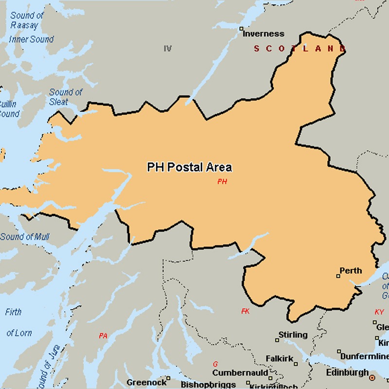
The PH postcode area, also known as the Perth postcode area, covers Aberfeldy, Acharacle, Arisaig, Auchterarder, Aviemore, Ballachulish, Blairgowrie, Boat of Garten, Carrbridge, Corrour, Crieff, Dalwhinnie, Dunkeld, Fort Augustus, Fort William, Glenfinnan, Grantown-on-Spey, Invergarry, Isle of Canna, Isle of Eigg, Isle of Rum, Kingussie, Kinlochleven, Lochailort, Mallaig, Nethy Bridge, Newtonmore, Perth, Pitlochry, Roy Bridge and Spean Bridge in Scotland.
Approximate total number of households in area: 66138
Get in touch with the team directly to arrange the leaflet distribution with them, or alternatively, get in touch with the leaflet network team to arrange this distribution for you. To come through the leaflet network there may be an added fee, but we will make sure to get every angle covered for you. For general enquiries please use the contact page.
| Postcode Sector | Households |
|---|---|
| PH1 1 | 3340 |
| PH1 2 | 5416 |
| PH1 3 | 3816 |
| PH1 4 | 1719 |
| PH1 5 | 3742 |
| PH10 6 | 2760 |
| PH10 7 | 1767 |
| PH11 8 | 1433 |
| PH12 8 | 705 |
| PH13 9 | 1599 |
| PH14 9 | 542 |
| PH15 2 | 1508 |
| PH16 5 | 1852 |
| PH17 2 | 110 |
| PH18 5 | 359 |
| PH19 1 | 46 |
| PH2 0 | 3330 |
| PH2 6 | 2925 |
| PH2 7 | 3027 |
| PH2 8 | 2032 |
| PH2 9 | 2271 |
| PH20 1 | 600 |
| PH21 1 | 840 |
| PH22 1 | 1341 |
| PH23 3 | 270 |
| PH24 3 | 290 |
| PH25 3 | 344 |
| PH26 3 | 1389 |
| PH3 1 | 2302 |
| PH30 4 | 6 |
| PH31 4 | 198 |
| PH32 4 | 299 |
| PH33 6 | 2603 |
| PH33 7 | 2071 |
| PH34 4 | 329 |
| PH35 4 | 129 |
| PH36 4 | 661 |
| PH37 4 | 57 |
| PH38 4 | 99 |
| PH39 4 | 170 |
| PH4 1 | 263 |
| PH40 4 | 93 |
| PH41 2 | 10 |
| PH41 4 | 391 |
| PH42 4 | 35 |
| PH43 4 | 11 |
| PH44 4 | 12 |
| PH49 4 | 460 |
| PH5 2 | 343 |
| PH50 4 | 535 |
| PH6 2 | 1135 |
| PH7 3 | 2159 |
| PH7 4 | 1126 |
| PH8 0 | 871 |
| PH9 0 | 397 |