Leaflet Distribution Slough
Leaflet Network
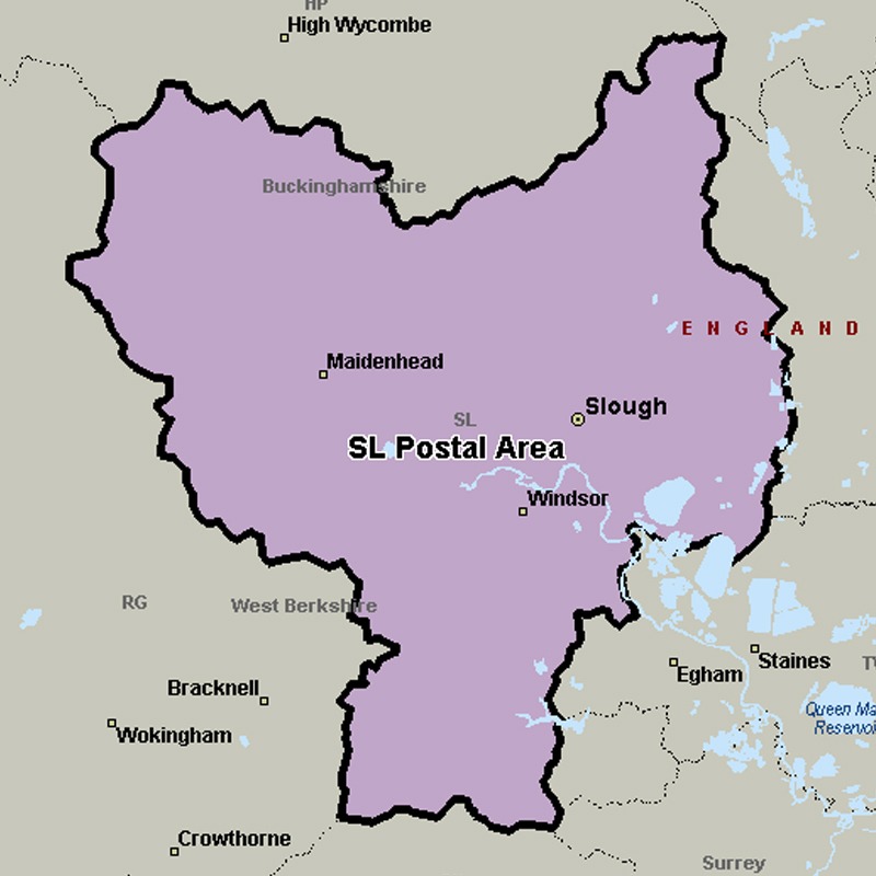
The SL postcode area, also known as the Slough postcode area, covers east Berkshire (including Slough, Maidenhead, Windsor and Ascot) and south Buckinghamshire (including Iver, Gerrards Cross, Marlow and Bourne End), plus a very small part of south-west Hertfordshire.
Approximate total number of households in area: 144453
Get in touch with the team directly to arrange the leaflet distribution with them, or alternatively, get in touch with the leaflet network team to arrange this distribution for you. To come through the leaflet network there may be an added fee, but we will make sure to get every angle covered for you. For general enquiries please use the contact page.
| Postcode Sector | Households |
|---|---|
| SL0 0 | 2361 |
| SL0 9 | 2040 |
| SL1 1 | 1969 |
| SL1 2 | 4655 |
| SL1 3 | 4658 |
| SL1 4 | 366 |
| SL1 5 | 4280 |
| SL1 6 | 2741 |
| SL1 7 | 2193 |
| SL1 8 | 1534 |
| SL1 9 | 1234 |
| SL2 1 | 5150 |
| SL2 2 | 3408 |
| SL2 3 | 2752 |
| SL2 4 | 1534 |
| SL2 5 | 5461 |
| SL3 0 | 1668 |
| SL3 6 | 1743 |
| SL3 7 | 4803 |
| SL3 8 | 6634 |
| SL3 9 | 2384 |
| SL4 1 | 1730 |
| SL4 2 | 2814 |
| SL4 3 | 3660 |
| SL4 4 | 4449 |
| SL4 5 | 4249 |
| SL4 6 | 2046 |
| SL5 0 | 1779 |
| SL5 7 | 2178 |
| SL5 8 | 2938 |
| SL5 9 | 2792 |
| SL6 0 | 2189 |
| SL6 1 | 2031 |
| SL6 2 | 4135 |
| SL6 3 | 4611 |
| SL6 4 | 3189 |
| SL6 5 | 2528 |
| SL6 6 | 3893 |
| SL6 7 | 3843 |
| SL6 8 | 2959 |
| SL6 9 | 2517 |
| SL7 1 | 3217 |
| SL7 2 | 2285 |
| SL7 3 | 3564 |
| SL8 5 | 2942 |
| SL9 0 | 2001 |
| SL9 7 | 2022 |
| SL9 8 | 1900 |
| SL9 9 | 2424 |