Leaflet Distribution Taunton
Leaflet Network
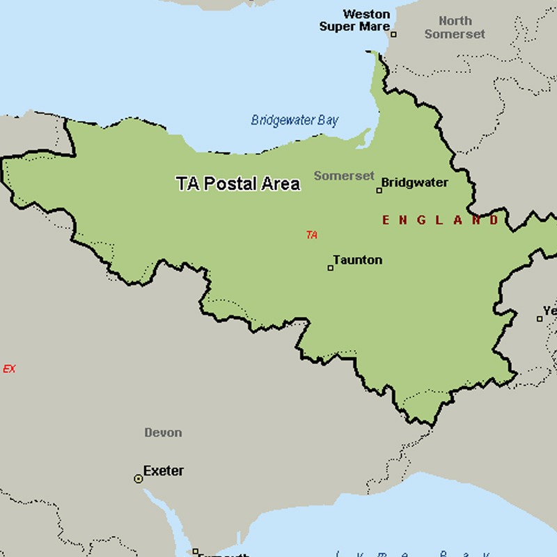
The TA postcode area, also known as the Taunton postcode area, covers western Somerset (including Taunton, Bridgwater, Burnham-on-Sea, Chard, Crewkerne, Dulverton, Highbridge, Hinton St George, Ilminster, Langport, Martock, Merriott, Minehead, Montacute, Somerton, South Petherton, Stoke-sub-Hamdon, Watchet and Wellington), plus very small parts of Dorset and Devon.
Approximate total number of households in area: 132984
Get in touch with the team directly to arrange the leaflet distribution with them, or alternatively, get in touch with the leaflet network team to arrange this distribution for you. To come through the leaflet network there may be an added fee, but we will make sure to get every angle covered for you. For general enquiries please use the contact page.
| Postcode Sector | Households |
|---|---|
| TA1 1 | 2513 |
| TA1 2 | 5825 |
| TA1 3 | 3173 |
| TA1 4 | 2979 |
| TA1 5 | 2827 |
| TA10 0 | 1568 |
| TA10 9 | 2076 |
| TA11 6 | 2598 |
| TA11 7 | 1130 |
| TA12 6 | 2586 |
| TA13 5 | 1779 |
| TA14 6 | 1341 |
| TA15 6 | 352 |
| TA16 5 | 835 |
| TA17 8 | 293 |
| TA18 7 | 1644 |
| TA18 8 | 2748 |
| TA19 0 | 2466 |
| TA19 9 | 2224 |
| TA2 6 | 3306 |
| TA2 7 | 4381 |
| TA2 8 | 2928 |
| TA20 1 | 3606 |
| TA20 2 | 3014 |
| TA20 3 | 1054 |
| TA20 4 | 891 |
| TA21 0 | 1448 |
| TA21 8 | 3278 |
| TA21 9 | 2814 |
| TA22 9 | 1296 |
| TA23 0 | 2376 |
| TA24 5 | 2557 |
| TA24 6 | 2715 |
| TA24 7 | 846 |
| TA24 8 | 2512 |
| TA3 5 | 2035 |
| TA3 6 | 1865 |
| TA3 7 | 1634 |
| TA4 1 | 1664 |
| TA4 2 | 1563 |
| TA4 3 | 1995 |
| TA4 4 | 1861 |
| TA5 1 | 2157 |
| TA5 2 | 1755 |
| TA6 3 | 3084 |
| TA6 4 | 5406 |
| TA6 5 | 2611 |
| TA6 6 | 4259 |
| TA6 7 | 2989 |
| TA7 0 | 1967 |
| TA7 8 | 2415 |
| TA7 9 | 1541 |
| TA8 1 | 3274 |
| TA8 2 | 4252 |
| TA9 3 | 3146 |
| TA9 4 | 1532 |