Leaflet Distribution Truro
Leaflet Network
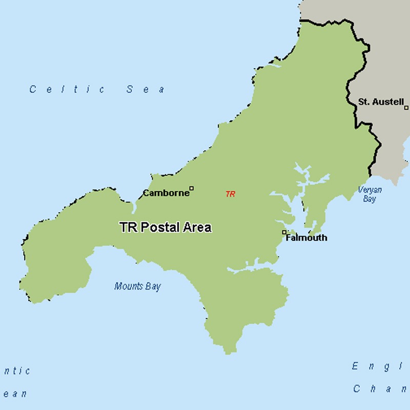
The TR postcode area, also known as the Truro postcode area, covers west Cornwall, including Truro, Penzance, Camborne, Falmouth, Hayle, Helston, Marazion, Newquay, Penryn, Perranporth, Redruth, St Agnes, St Columb and St Ives, plus the Isles of Scilly.
Approximate total number of households in area: 122071
Get in touch with the team directly to arrange the leaflet distribution with them, or alternatively, get in touch with the leaflet network team to arrange this distribution for you. To come through the leaflet network there may be an added fee, but we will make sure to get every angle covered for you. For general enquiries please use the contact page.
| Postcode Sector | Households |
|---|---|
| TR1 1 | 3477 |
| TR1 2 | 1397 |
| TR1 3 | 3462 |
| TR10 8 | 2606 |
| TR10 9 | 1069 |
| TR11 2 | 3663 |
| TR11 3 | 1649 |
| TR11 4 | 3225 |
| TR11 5 | 3784 |
| TR12 6 | 1790 |
| TR12 7 | 2146 |
| TR13 0 | 1572 |
| TR13 8 | 3843 |
| TR13 9 | 2523 |
| TR14 0 | 1911 |
| TR14 7 | 3752 |
| TR14 8 | 3348 |
| TR14 9 | 1142 |
| TR15 1 | 2569 |
| TR15 2 | 2033 |
| TR15 3 | 3101 |
| TR16 4 | 2308 |
| TR16 5 | 2215 |
| TR16 6 | 1554 |
| TR17 0 | 768 |
| TR18 2 | 2518 |
| TR18 3 | 2577 |
| TR18 4 | 2217 |
| TR18 5 | 1723 |
| TR19 6 | 1683 |
| TR19 7 | 2666 |
| TR2 4 | 2090 |
| TR2 5 | 2523 |
| TR20 8 | 2012 |
| TR20 9 | 1826 |
| TR21 0 | 717 |
| TR22 0 | 30 |
| TR23 0 | 34 |
| TR24 0 | 99 |
| TR25 0 | 35 |
| TR26 1 | 2397 |
| TR26 2 | 2618 |
| TR26 3 | 833 |
| TR27 4 | 2732 |
| TR27 5 | 1761 |
| TR27 6 | 1263 |
| TR3 6 | 3387 |
| TR3 7 | 1857 |
| TR4 8 | 2577 |
| TR4 9 | 1775 |
| TR5 0 | 1724 |
| TR6 0 | 1743 |
| TR7 1 | 2150 |
| TR7 2 | 3370 |
| TR7 3 | 2192 |
| TR8 4 | 1429 |
| TR8 5 | 1742 |
| TR9 6 | 2864 |