Leaflet Distribution Walsall
Leaflet Network
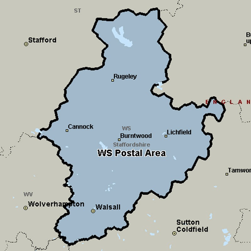
The WS postcode area, also known as the Walsall postcode area, covers the northern part of the West Midlands (including Walsall and Wednesbury) and much of south-east Staffordshire (including Lichfield, Cannock, Burntwood and Rugeley).
Approximate total number of households in area: 147898
Get in touch with the team directly to arrange the leaflet distribution with them, or alternatively, get in touch with the leaflet network team to arrange this distribution for you. To come through the leaflet network there may be an added fee, but we will make sure to get every angle covered for you. For general enquiries please use the contact page.
| Postcode Sector | Households |
|---|---|
| WS1 1 | 275 |
| WS1 2 | 3025 |
| WS1 3 | 3086 |
| WS1 4 | 3127 |
| WS10 0 | 5545 |
| WS10 7 | 2301 |
| WS10 8 | 4725 |
| WS10 9 | 5097 |
| WS11 1 | 3906 |
| WS12 4 | 6140 |
| WS13 6 | 3104 |
| WS13 7 | 4703 |
| WS13 8 | 1842 |
| WS14 0 | 1549 |
| WS14 9 | 4985 |
| WS15 1 | 3989 |
| WS15 2 | 5582 |
| WS15 3 | 1595 |
| WS15 4 | 2940 |
| WS2 0 | 3516 |
| WS2 7 | 3243 |
| WS2 8 | 3533 |
| WS2 9 | 4445 |
| WS3 1 | 5498 |
| WS3 2 | 6060 |
| WS3 3 | 5432 |
| WS3 4 | 3723 |
| WS3 5 | 840 |
| WS4 1 | 5158 |
| WS4 2 | 2136 |
| WS5 3 | 3675 |
| WS5 4 | 4515 |
| WS6 6 | 3851 |
| WS6 7 | 3375 |
| WS7 0 | 1674 |
| WS7 9 | 2076 |
| WS8 6 | 2705 |
| WS8 7 | 3834 |
| WS9 0 | 3702 |
| WS9 8 | 3960 |
| WS9 9 | 3431 |