Leaflet Distribution Wolverhampton
Leaflet Network
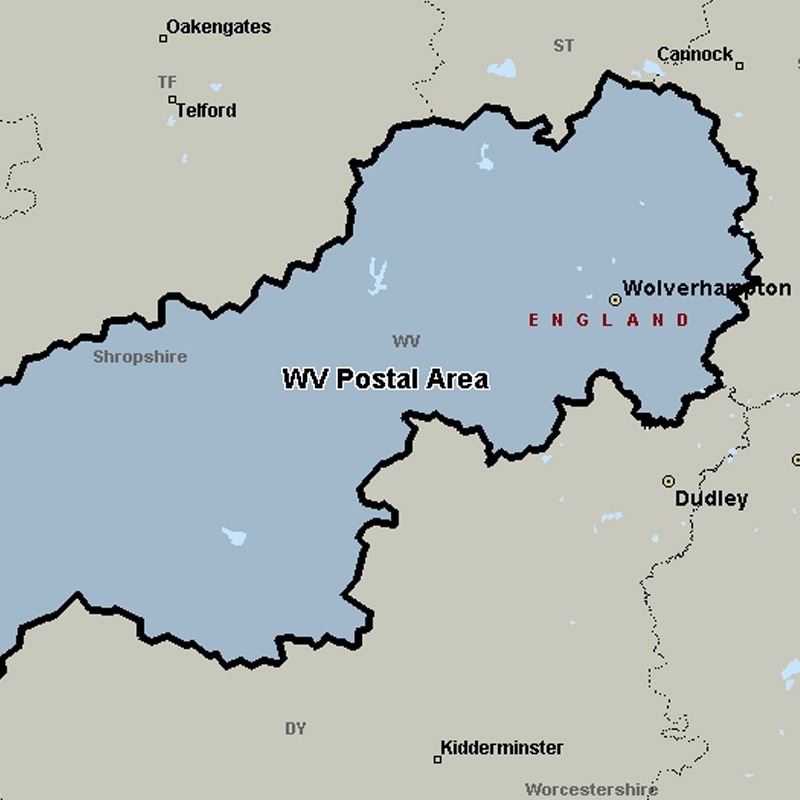
The WV postcode area, also known as the Wolverhampton postcode area, covers Wolverhampton, Willenhall and Bilston in the West Midlands, plus parts of south-west Staffordshire and south-east Shropshire (including Bridgnorth).
Approximate total number of households in area: 160150
Get in touch with the team directly to arrange the leaflet distribution with them, or alternatively, get in touch with the leaflet network team to arrange this distribution for you. To come through the leaflet network there may be an added fee, but we will make sure to get every angle covered for you. For general enquiries please use the contact page.
| Postcode Sector | Households |
|---|---|
| WV1 1 | 382 |
| WV1 2 | 4202 |
| WV1 3 | 221 |
| WV1 4 | 1658 |
| WV10 0 | 4445 |
| WV10 6 | 4980 |
| WV10 7 | 2415 |
| WV10 8 | 4872 |
| WV10 9 | 5152 |
| WV11 1 | 4848 |
| WV11 2 | 4884 |
| WV11 3 | 4982 |
| WV12 4 | 4243 |
| WV12 5 | 6177 |
| WV13 1 | 2373 |
| WV13 2 | 2331 |
| WV13 3 | 3366 |
| WV14 0 | 2272 |
| WV14 6 | 3462 |
| WV14 7 | 1527 |
| WV14 8 | 6327 |
| WV14 9 | 5499 |
| WV15 5 | 1851 |
| WV15 6 | 1598 |
| WV16 4 | 3043 |
| WV16 5 | 1186 |
| WV16 6 | 2437 |
| WV2 1 | 1122 |
| WV2 2 | 2218 |
| WV2 3 | 1918 |
| WV2 4 | 904 |
| WV3 0 | 3028 |
| WV3 7 | 3130 |
| WV3 8 | 2769 |
| WV3 9 | 3677 |
| WV4 4 | 5345 |
| WV4 5 | 3895 |
| WV4 6 | 4084 |
| WV5 0 | 2464 |
| WV5 7 | 1018 |
| WV5 8 | 1510 |
| WV5 9 | 1447 |
| WV6 0 | 5249 |
| WV6 7 | 5428 |
| WV6 8 | 4681 |
| WV6 9 | 3053 |
| WV7 3 | 2635 |
| WV8 1 | 4897 |
| WV8 2 | 1639 |
| WV9 5 | 3306 |